")
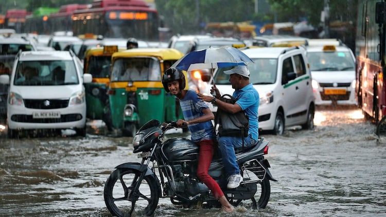
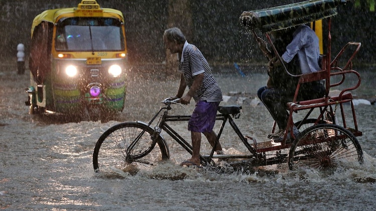
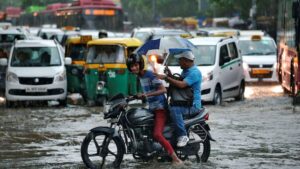
Just as Delhiites were bracing for a scorching summer, the skies performed a rare and dramatic U-turn. The Palam Airport observatory recorded 19mm of rainfall in the 24-hour period ending at 8:30am today, April 18.
This is not just a passing shower, but the highest rainfall recorded in a single day in April for at least 14 years.
While the sudden downpour turned the city’s dusty streets into cool avenues, the science behind this Delhi-specific rain is a fascinating story of two opposing weather forces colliding.
HOW DID RAIN HAPPEN DURING THE PEAK OF SUMMER?
The rainfall was caused by a feeble Western Disturbance. A Western Disturbance is an extra-tropical storm that originates in the Mediterranean region. It brings sudden winter rain to the north-western parts of India.
Usually, these systems are quite weak by April. However, this specific event was intensified by heat convection. Convection is a process where the Sun heats the ground, causing the air above it to rise rapidly.
Think of the Western Disturbance as the provider of raw material. It carried a thin layer of moisture high in the atmosphere, but lacked the power to create a storm.
Meanwhile, the intense local heat acted as a spark. As the parched ground heated the air, it rose like an elevator, catching that Mediterranean moisture and forcing it to condense rapidly.
Without the heat to trigger this upward surge, the moisture would have simply drifted away without falling as rain.
As this warm air ascends, it cools and condenses into clouds. Yesterday, the intense local heat provided the necessary energy for these clouds to dump significant rain over specific pockets of the capital.
WHY WAS THE RAINFALL SO SPECIFIC TO DELHI?
The event was highly localised. Independent weather experts noted that while the Western Disturbance provided the moisture, the actual rain was triggered by the city’s own heat.
This is often called a heat-triggered storm. Because the moisture only turned into rain where the surface heat was strongest, the storm remained concentrated over the city’s concrete heat islands.
These heat islands are urban areas that experience much higher temperatures than surrounding rural spots because the dense concentration of pavement, buildings, and roads absorbs and retains significantly more heat.
Since the atmospheric system was not broad or powerful, the rain did not spread across the entire region but stayed concentrated over Delhi.
IS THE HEATWAVE RETURNING TO THE CAPITAL?
The relief is short-lived. With the moisture clearing out, skies are back to being bright and sunny.
Experts predict that temperatures will climb back to 40 degrees Celsius starting today. This transition marks the official start of the harsh summer mode.
The moisture in the air might initially cause some humidity, but the dry heat typical of late April is expected to dominate the coming week.
Residents should prepare for a sharp climb in the mercury as the cooling effect of the record rain evaporates.


