")
Monday marked a significant shift in India’s weather from it had been in since late April.
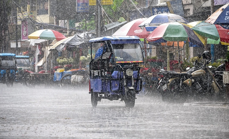
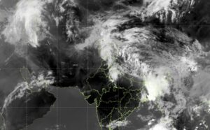
After weeks of relentless heat dominating the headlines, large parts of the country finally received rainfall, though the relief was far from uniform, and temperatures in some pockets remained dangerously high.
SUMMER AND STORMS
In Uttarakhand, the Kedarnath Yatra is progressing steadily amid continued rainfall and challenging conditions. Low visibility, fog, and rain have disrupted helicopter services in Rudraprayag, leading authorities to enforce strict safety protocols.
Pilgrims with pre-booked flights may face delays, while trekkers are advised to exercise caution and carry rain gear for the expected wet and misty conditions on Tuesday.

Uttarakhand, Haryana, Chandigarh and Delhi, saw rainfall in most places, while West Bengal, Sikkim, West Uttar Pradesh, and Himachal Pradesh received rain in some places.
In West Uttar Pradesh, some stations recorded particularly heavy totals.
For instance, Gunnaur in Sambhal district logged 13 cm of rain and Sahawar in Kasganj recorded 10 cm.
Heavy rain was also reported in isolated places throughout Sub-Himalayan West Bengal, Sikkim and Andhra Pradesh.
Delhi’s Karnal station recorded 6 cm of rain showers, too.
Meanwhile, in Rajasthan, the heat showed no mercy.
Phalodi recorded the country’s highest maximum temperature of the day at 44.8°C on May 3, while Vidarbha continued to see maximum temperatures running 3 to 5°C above normal.
The lowest minimum temperature over the plains was 15°C, recorded at Hardoi in Uttar Pradesh, marking the first time in weeks that a plains station dipped to such a relatively cool overnight low, a sign that the weather pattern is slowly shifting.

HAILSTORMS AND HEAVY RAINS AHEAD
Looking forward, Tuesday is shaping up to be one of the most widely impactful weather days of the season so far, with alerts covering nearly every corner of the country.
North India is expected to face a turbulent day with scattered to fairly widespread rainfall with thunderstorms and gusty winds of 30 to 50 kmph forecast over Punjab, Haryana, Delhi, and West Uttar Pradesh.
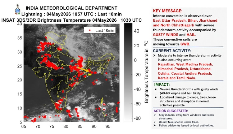
Sudden, violent bursts of wind reaching 50 to 60 kmph and gusting up to 70 kmph, called thundersqualls, are very likely over Chhattisgarh, coastal Andhra Pradesh, East Uttar Pradesh, Gangetic West Bengal, Jharkhand, Madhya Pradesh, and Odisha.
Hailstorms remain very likely over East Uttar Pradesh, Jharkhand, and Odisha.
Coming to East India and the hills, the regions will continue to bear the brunt of heavy rainfall, which remains very likely in isolated places over Arunachal Pradesh, Assam & Meghalaya, Coastal Andhra Pradesh, Jharkhand, Odisha, Sub-Himalayan West Bengal & Sikkim, and Tamil Nadu.
South India should not expect a calm day either.

Kerala & Mahe face heavy rainfall during the next five days. Tamil Nadu, Puducherry, and Karaikal can expect rain and thunderstorms with winds of 30 to 40 kmph.
No heat wave warnings have been issued for May 5, which is a notable development after weeks of relentless alerts.
But hot and humid conditions will continue to persist in isolated pockets of Andhra Pradesh.
HEAT IS STEPPING BACK
The reason for this dramatic weather shift is a combination of factors now at work.
A western disturbance, which is a weather system that travels eastward from the Mediterranean and brings moisture and instability to northern India, is currently active, with its axis positioned near Rajasthan and Gujarat.
Additionally, a fresh western disturbance is expected to arrive and affect the Western Himalayan region from May 10 onwards, ensuring that the hills remain unsettled well into the coming week.
Temperatures across northwest India are expected to fall by a further 2 to 4°C by May 4–5, before rising again by 4-6°C during May 5–9, suggesting the window of cool relief will be narrow.
Central India’s temperatures are expected to fall by 2-3°C through May 6.


