")
India is about to launch a technological marvel into the heavens. Bengaluru-based startup GalaxEye Space will see its crown jewel, Mission Drishti, soar into orbit aboard a SpaceX rocket, on May 3, 2026.
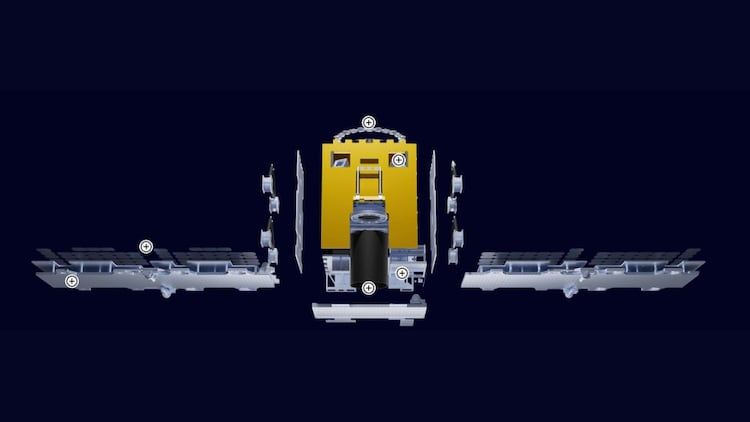
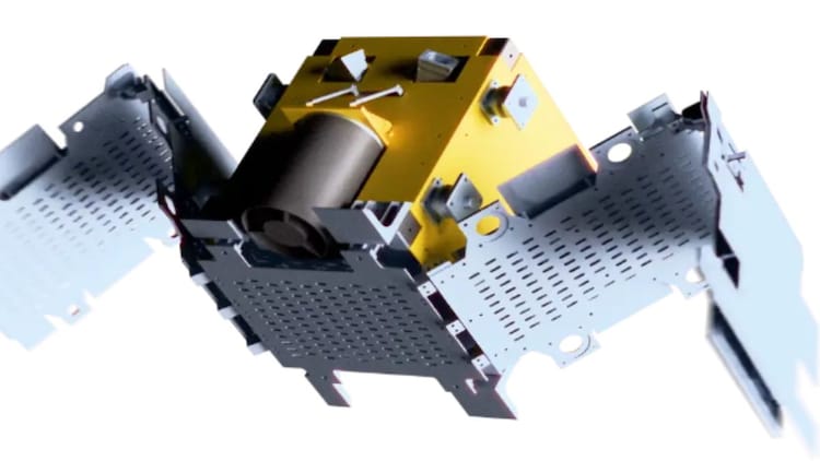
This is not just another satellite; it is a 190-kg powerhouse and the largest satellite ever built by a private Indian company.
WHAT IS MISSION DRISHTI?
Mission Drishti is special because it uses something called OptoSAR. Usually, satellites carry one type of camera.
Some use optical sensors, which take pictures like your smartphone but cannot see through clouds or at night.
OptoSAR is a breakthrough hybrid technology that combines the intuitive clarity of optical cameras with the all-weather reliability of Synthetic Aperture Radar on a single satellite.
While standard optical sensors are often blinded by thick clouds or nighttime darkness, the radar component of OptoSAR pierces through these obstacles using radio waves to ensure constant visibility.
By capturing both data streams simultaneously in a single pass, the system produces a fused image that aligns the rich colours and details of a traditional photograph with the structural precision of radar.
This innovation provides three times more information than a standalone sensor, giving users a crystal clear and dependable view of Earth regardless of the weather conditions or the time of day.
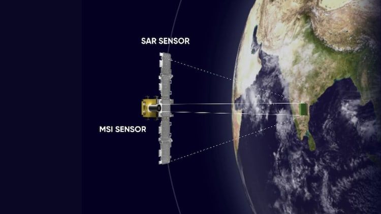
Others use Synthetic Aperture Radar (SAR), which sends out radio waves to create images.
SAR is great because it peers through thick clouds and darkness, but the pictures can look grainy and hard to read.
GalaxEye has combined both onto one platform. By fusing these two, they provide a crystal clear view of Earth regardless of the weather.
WHY IS MISSION DRISHTI IMPORTANT FOR INDIA?
Think of this satellite as a sharp eye in the sky that never blinks.
Because it combines multi-spectral imaging (MSI) with radar, it offers three times more information than usual satellites.
MSI captures different light frequencies, including those invisible to humans, helping us see the health of crops or the chemical makeup of land.
Mission Drishti aligns these images perfectly in a single pass.
This is a game changer for the Indian Army and disaster management teams, who need reliable data during monsoon clouds or pitch black nights.
HOW DOES ARTIFICIAL INTELLIGENCE HELP IN SPACE?
The satellite is powered by an NVIDIA Jetson Orin processor, which acts like a brain in space.
This edge computing allows the satellite to process data while still in orbit rather than sending raw files back to Earth.
It uses AI to turn complex radar data into intuitive, optical-like images.
This helps in detecting changes on the ground, such as new construction or moving vehicles, with a 1.8-metre resolution.
By 2029, GalaxEye hopes to have a fleet of these eyes providing daily updates for a safer planet.


