US Cities Deploy AI for Road Safety as Traffic Deaths Rise
American cities are turning to artificial intelligence to tackle deteriorating road infrastructure and rising traffic fatalities. From Hawaii to Texas, local governments are implementing AI-powered systems that detect hazards in real-time, replacing months-long manual inspections.
Key Takeaways
- AI systems detect potholes, damaged guardrails, and obscured signs with high accuracy
- Hawaii’s program already distributed 1,000 AI dashcams to combat traffic deaths
- San Jose’s system identifies potholes with 97% accuracy using street sweeper cameras
- Texas uses AI to scan 250,000 lane miles of roadway infrastructure
Hawaii’s AI Dashcam Initiative
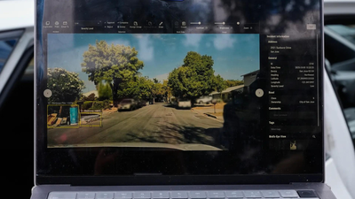
Hawaii has launched an “Eyes on the Road” program distributing 1,000 AI-enabled dashboard cameras to address increasing traffic fatalities. The technology automatically identifies damaged guardrails, missing road signs, and worn pavement markings, sending immediate alerts for repairs.
“This is not something where it’s looked at once a month and then they sit down and figure out where they’re going to put their vans,” said Richard Browning of Nextbase, which developed the system.
Roger Chen of the University of Hawaii noted the state’s geographic challenges complicate maintenance. “Equipment has to be shipped to the island… it’s not an easy problem,” he explained.
The urgency follows a $3.9 million lawsuit settlement after a 2020 fatal accident involving an unrepaired guardrail. By October 2025, Hawaii had recorded 106 traffic fatalities – already exceeding the previous year’s total.
San Jose’s Camera Network Expansion
San Jose is expanding its AI pilot program using cameras mounted on street sweepers and parking enforcement vehicles. City officials report the system correctly identifies potholes 97% of the time.
Mayor Matt Mahan emphasized the importance of data sharing between cities. “We could wait five years for that to happen here, or maybe we have it at our fingertips,” he stated.
San Jose helped establish the GovAI Coalition in 2024, bringing together members from California, Minnesota, Oregon, Texas, Washington, and Colorado.
Texas’s Massive Roadway Assessment
Texas, with more roadway miles than the next two largest states combined, uses AI tools to assess street signs, analyze congestion, and scan its extensive network.
Jim Markham of the Texas Department of Transportation said AI helped identify outdated signs across 250,000 lane miles. “Having AI that can go through and screen for that is a force multiplier,” he noted.
The state also employs StreetVision, a mobile tool detecting dangerous driving patterns. In one Washington D.C. case, data revealed sudden braking caused by a bush obscuring a stop sign.
“That brought me to an infrastructure problem, and the solution… was a pair of garden shears,” said Ryan McMahon of Cambridge Mobile Telematics.
Preparing for Autonomous Vehicles
Experts view these AI implementations as crucial steps toward infrastructure ready for both human drivers and . Mark Pittman, CEO of Blyncsy, predicted most new vehicles will soon feature built-in cameras.
“They’re now building infrastructure for humans and automated drivers alike, and they need to start bridging that divide,” Pittman said.


