")
A massive atmospheric tug of war played out over North and Central India this Saturday, and the meteorological drama is far from over.
A powerful Western Disturbance has effectively hijacked the spring weather, replacing the early April warmth with a volatile cocktail of thundersqualls, intense rain and ice.
While parts of the capital witnessed a dark, wintry spectacle today, the India Meteorological Department (IMD) warns that the instability is now shifting its focus.
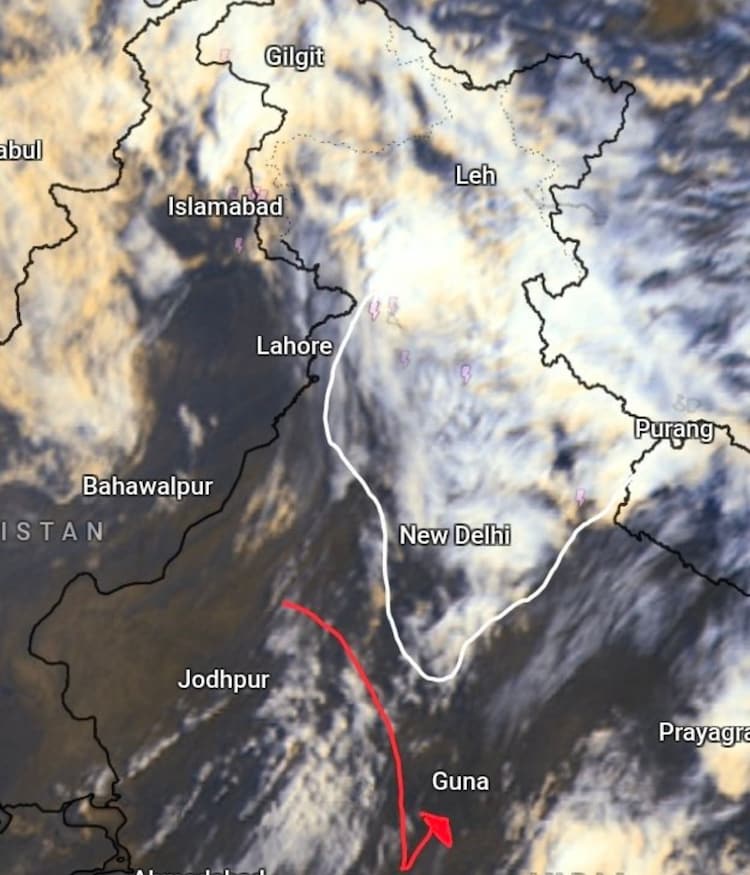
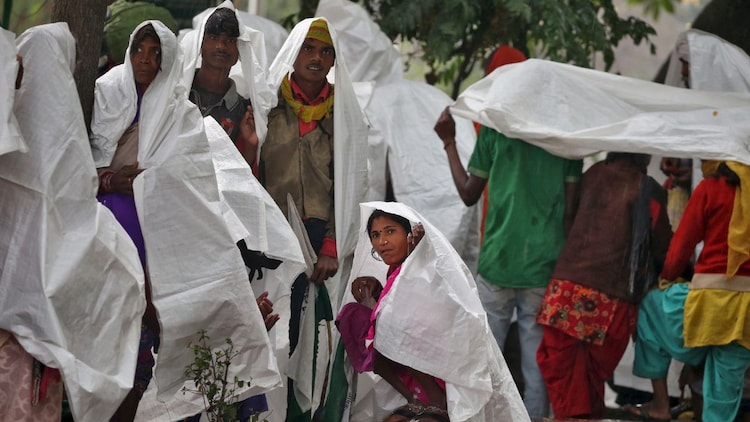
The India Meteorological Department (IMD) has issued a yellow alert for Delhi-NCR, as a 1,000-kilometre cloud band stretched across the region, turning the afternoon sky into a dark, wintry spectacle.
WHAT IS TRIGGERING THIS UNSEASONAL RAIN?
The culprit is a particularly aggressive Western Disturbance. Think of it as a massive, moisture-laden conveyor belt originating from the Mediterranean.
As it travels toward India, it interacts with warm, rising air from the plains. This creates what scientists call pre-monsoon convective activity.
When the Sun heats the ground, warm air rises rapidly. If it meets the cold, moist air of a Western Disturbance, it condenses into towering cumulonimbus clouds.
These clouds are atmospheric engines that produce sudden, violent bursts of rain.
The structure of this specific system is rare, spanning thousands of kilometres in a straight line, which explains the widespread chaos seen across the northern plains.
WHICH REGIONS ARE UNDER SEVERE THREAT THIS SUNDAY?
While the most dangerous window for Delhi-NCR and Haryana peaked on Saturday, the weather drama is moving deeper into the heart of the country.
On Sunday, the focus of the intense activity will shift toward the central and eastern parts of the northern belt.
Residents in Jhansi, Gwalior and parts of North Madhya Pradesh should be on high alert. These regions are expected to face serious thunderstorm activity and potential thundersqualls by tomorrow afternoon or evening.
A thundersquall is a sudden, violent increase in wind speed that lasts for several minutes, with gusts potentially reaching 60 to 70 kilometres per hour.
These winds are strong enough to damage temporary structures and flatten standing crops**, which is why the IMD has urged residents to remain watchful.
WHY IS HAIL FALLING IN APRIL?
Hail is the most destructive byproduct of these intense spring storms.
Inside the massive thunderclouds, powerful updrafts, which are currents of rising air, push water droplets high into the freezing layers of the atmosphere.
These droplets freeze into ice pellets. They are tossed up and down, gathering layers of ice like an onion, until they become too heavy for the wind to hold, and fall to the ground.
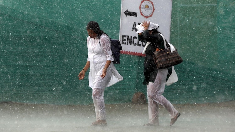
While the rain provides a welcome dip in temperature of about 5 degrees Celsius, the ice is bad news for farmers.
This unseasonal activity has already caused significant crop damage in Rajasthan and Haryana.
With the system moving toward West Uttar Pradesh and Madhya Pradesh on Sunday, the agricultural risk remains high. Residents in the path of the storm are urged to remain watchful as the Western Disturbance continues its journey across the subcontinent.


