Key Takeaways
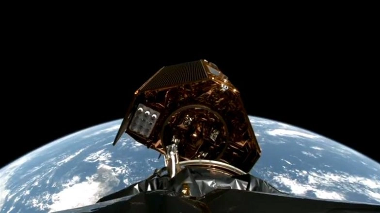
- SpaceX successfully launched NASA’s Sentinel-6B satellite to monitor global sea level changes.
- The satellite will enhance weather forecasting, coastal planning, and disaster preparedness.
- It provides data covering 90% of Earth’s oceans, building on over 30 years of climate records.
SpaceX has launched NASA’s Sentinel-6B satellite, a crucial mission dedicated to tracking sea level rise and improving global weather forecasts. The launch occurred from Vandenberg Space Force Base at 12:21 am ET (10:55 AM IST) on Monday.
This Earth-observing satellite was developed through a collaboration between NASA, US agencies, and European partners. It continues a three-decade-long record of sea level measurements.
Mission Objectives and Benefits
Sentinel-6B will deliver comprehensive data on approximately 90% of Earth’s oceans. This information directly supports:
- Improved coastal infrastructure planning and protection
- Enhanced weather and hurricane forecasting
- Public safety and disaster response efforts
- Commercial navigation and national defense operations
NASA announced the successful launch on social media platform X, stating:
“Liftoff! The latest in a long line of satellites to monitor sea level change, Sentinel-6B, successfully launched at 12:21 am ET (10:55 AM IST) on Monday, from Vandenberg Space Force Base.”
SpaceX added that this marks their second Sentinel-6 satellite launch, following the Sentinel-6 Michael Freilich satellite deployed in November 2020. Together, these spacecraft provide critical ocean current, wind, and wave condition data.
Long-term Applications
The satellite’s data will assist city planners and government agencies in making informed decisions about protecting coastal real estate and energy facilities. It will also contribute to NASA’s Artemis program by supporting safer astronaut reentry procedures.
For meteorologists, the enhanced sea level measurements improve predictions of hurricane development and storm intensification, crucial for early warning systems. The data also helps protect military installations from nuisance flooding while supporting defense operations with accurate ocean condition information.


