")
March opened with soaring temperatures, and soon after, we were ushered into April by a spell of hail and rain and dropping temperatures.
If you have been confused by India’s whiplash weather lately, you are not alone. The culprit is a weather system called a western disturbance.
Although the system commonly hits India every year and brings winter rain, 2026 has seen the system arrive several times, and that too much later in the year.
It is, without debate, something that is largely uncommon and raises the question about why India’s weather is behaving so unpredictably.
WHAT IS WESTERN DISTURBANCE?
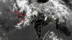
Think of a western disturbance as a large, travelling blob of disturbed air that is born somewhere near the Mediterranean Sea.
It originates as an extratropical storm in the Mediterranean region, then travels eastward across the Middle East, Iran, Afghanistan, and Pakistan before entering the Indian subcontinent. What makes it different from our monsoon rains is where it carries its moisture. Western disturbances carry moisture in the upper layers of the atmosphere and this moisture eventually falls as snow over the Himalayas and rain over the plains.
India normally sees four to six intense western disturbances per month between December and February, totalling to roughly 16 to 24 systems a year.
By late March, this activity typically tapers off as the high-altitude winds that steer these systems weaken and shift northward, making large-scale disturbances a rarity, statistically occurring only once or twice a year during this period.
WHY IS INDIA SEEING UNEXPECTED WEATHER CHANGES?
Here is where things get uncomfortable.
Recent meteorological trends indicate a shift in this seasonal cycle. The western disturbance season appears to be lengthening, with an increasing frequency of these storms persisting into April.
The science points squarely at climate change.

The rapid warming of the Tibetan Plateau at a rate almost twice the global average is creating a larger temperature change when compared to the surrounding areas, fuelling a stronger jet stream.
The jet stream is a fast-moving river of wind that flows roughly 8 to 15 kilometres above the Earth’s surface. It acts like a conveyor belt, steering weather systems from west to east across continents.
At the same time, global warming is weakening the temperature difference between the equator and poles that normally draws the jet stream northward in summer, causing it to linger at southerly latitudes later into spring, allowing more storms to strike North India.
Over the past 70 years, western disturbances have increased in frequency by 60% from April to July.
The impacts this season have been broad and damaging.
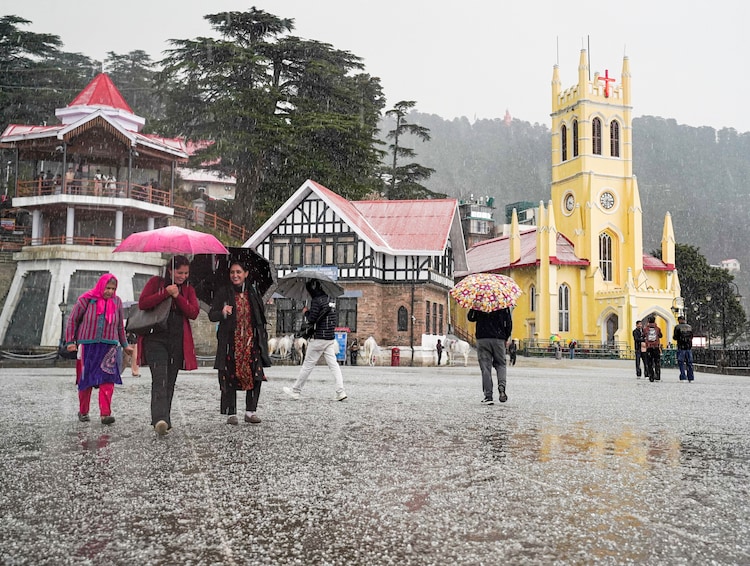
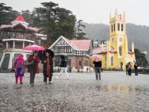
In March 2026, western disturbances triggered heavy rainfall and hailstorms across Himachal Pradesh, Uttarakhand, Punjab, Haryana, Odisha, and West Bengal.

March was unexpected in more ways than one.
The month had a warm start, marking an early end of winter. The temperatures rose and prompted people across India to pack away their woollen attires.
And right when people started warming up to the heat, March flipped the weather on its head. It brought sudden temperature drops, confusing many about whether winter was gone or was still planning to stick around.
And then the month, out of nowhere, brought showers and hail.
Hailstorms damaged wheat, maize, and horticultural crops in Punjab, Haryana, Maharashtra, and Karnataka. Three major systems arrived within ten days, which was brutal timing for farmers trying to bring in the rabi harvest.
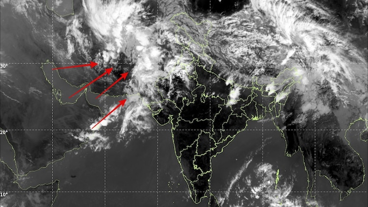
As of April 1, the India Meteorological Department (IMD) confirmed that two active western disturbances are still driving a wet spell over northwest India and these conditions are expected to last until the end of the month.


