")
The sky above Western Australia recently transformed into a scene from a science fiction movie, leaving residents and social media users questioning if they were looking through a digital filter.
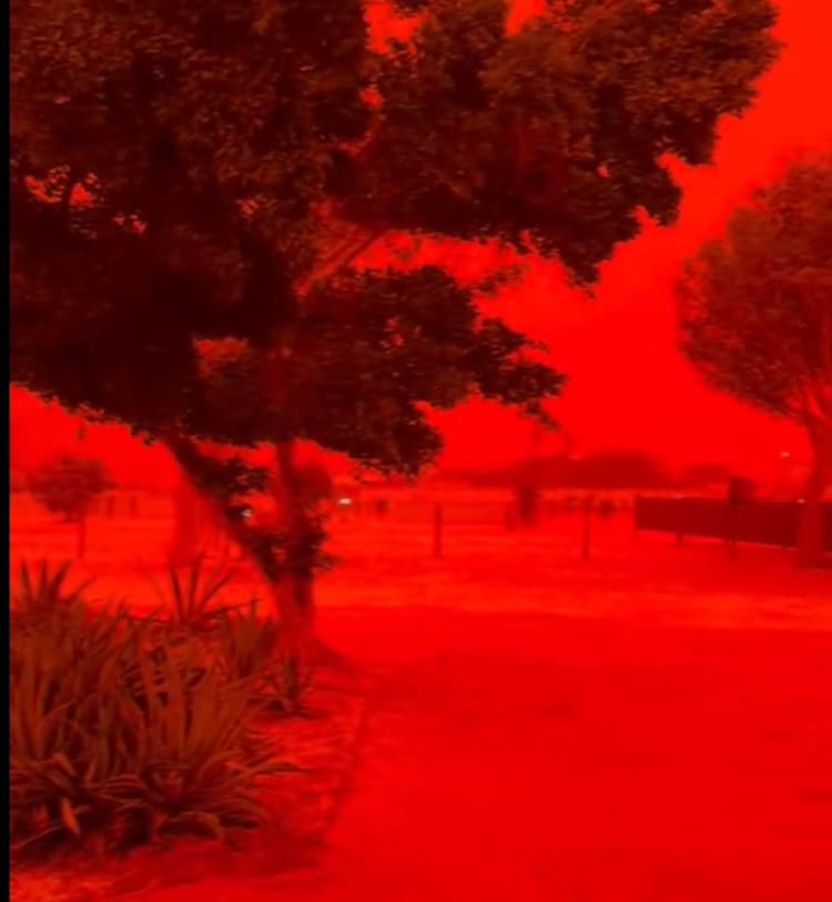
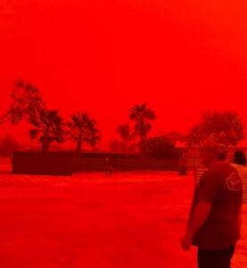
On March 27, 2026, the horizon in regions like Shark Bay and the Pilbara turned a deep, blood-red hue. This was not a camera trick or a cinematic stunt, but a powerful atmospheric event triggered by Tropical Cyclone Narelle.
As the severe storm approached the coast, its intense winds vacuumed up massive quantities of iron-rich dust from the arid Australian outback, suspending it in the atmosphere to create an eerie crimson daylight.
The Australian outback is the vast, remote, and sparsely populated interior that covers more than 70 per cent of the Australian continent. It is not a single specific location but rather a massive region encompassing most of Western Australia, the Northern Territory, South Australia, and Queensland.
WHY DID THE AUSTRALIAN SKY TURN RED?
The dramatic colour shift is explained by the physics of light scattering. Usually, the sky appears blue because of Rayleigh scattering.
This occurs when sunlight strikes the small molecules of nitrogen and oxygen in our atmosphere.
Because these molecules are much smaller than the wavelength of visible light, they scatter shorter wavelengths, blue and violet, more effectively, which is why we see a blue sky during the day.
However, when a cyclone lofts larger particles like dust and mineral aerosols, or tiny solid particles suspended in the air, a different phenomenon called Mie scattering takes over.
Unlike Rayleigh scattering, Mie scattering happens when the atmospheric particles are of a similar size to the wavelength of the light hitting them.
In this case, the dust in Western Australia is particularly high in iron oxide, or hematite, which is a chemical compound of iron and oxygen that naturally reflects red light.
These large particles act as a filter, blocking shorter blue and green wavelengths while allowing the longer red wavelengths to pass through. This created a vivid crimson effect similar to the atmospheric conditions seen on Mars.
IS TROPICAL CYCLONE NARELLE AN UNUSUAL STORM?
Meteorologists have noted that Tropical Cyclone Narelle is a rare meteorological event due to its historic path.
It is only the third storm in recorded history to make landfall on three separate Australian coastlines, crossing from Queensland through the Northern Territory before re-intensifying off the Western Australian coast.
Before making landfall on March 27, it peaked as a Category 3-4 severe tropical cyclone, a classification used to describe storms with very destructive winds and significant risk to property.
The storm brought destructive winds exceeding 125 kilometres per hour and heavy rainfall, but it was the pre-storm dust surge that captured global attention.
WHAT ARE THE ENVIRONMENTAL RISKS OF DUST STORMS?
Beyond the visual spectacle, these dust-laden storms carry significant ecological and health implications. High concentrations of mineral dust can reduce air quality to hazardous levels and impact visibility for transport.

In the context of climate change, the intensification of cyclones and the drying of continental interiors are expected to make such apocalyptic dust events more frequent.
Scientists are monitoring how these iron-rich aerosols settle into the ocean, as they can trigger nutrient cycles, the process by which minerals move from the physical environment into living organisms, that affect marine life in the Indian Ocean.


